Birdsie Warm Spring
Near Creede, Colorado, United States
A warm spring recorded on federal maps beside Highway 149 in the upper Rio Grande valley southwest of Creede, with no known pool, operator or public access.
Closed to the public. Not a public soaking site. The mapped spring sits beside Highway 149 on land that federal land-status data shows as private, and no pool, operator or public access is documented.
- Water temperature
- Not published
- Entry
- Paid
- Getting in
- Drive-up
- Type
- Wild & natural
- Listed in the federal place-name database as a spring at about 8,924 feet, beside Highway 149 in Mineral County.
- Federal land-status data places the mapped point on private land, with Rio Grande National Forest land close by.
- No temperature, pool or visitor facilities are recorded in any source we could find.
- Creede, the nearest town, is roughly 11 miles to the northeast in a straight line.
What to expect
Birdsie Warm Spring is a name on the map more than a place to visit. The US Geological Survey’s Geographic Names Information System lists it as a spring in Mineral County, Colorado, and Wikipedia’s list of Colorado hot springs repeats that entry with an elevation of about 8,924 feet and a note that it is reached from Colorado Highway 149. Beyond that, the public record is thin.
We could not find a published water temperature, a flow rate, a description of a pool or any operator. There are no reviews from people who have soaked there, no Forest Service recreation page and no commercial listing. In short, nothing suggests there is anything here to soak in.
The location is the other reason to set expectations low. When we checked the mapped coordinates against the Bureau of Land Management’s national surface management data, the point falls on private land, with Rio Grande National Forest land nearby on either side. Place-name coordinates can be off by a few hundred feet, so the spring itself might sit on either side of that line, but you should assume it is on private property unless you have the landowner’s permission.
That is why this listing is marked as not open. If the situation changes, for example if a landowner opens the spring to visitors or a land agency documents public access, we will update it.
Why it is on our list
Hot spring directories often pull names straight from federal map data, which is how springs like Birdsie end up on lists of places to soak. A name in the Geographic Names Information System only means that surveyors recorded a feature there at some point. It says nothing about whether the water is warm enough to enjoy, whether anyone has built a pool, or whether the public can reach it.
We include Birdsie so that people who come across the name elsewhere can find a straight answer before they drive. If you are planning a trip to the upper Rio Grande around Creede, spend your soaking time at an established spring instead.
Getting there
You can drive past the mapped location, but there is no signed pullout, trail or parking area.
The spring is plotted right beside Highway 149, which this stretch of road shares with the Silver Thread Scenic Byway. From Creede, the highway heads southwest and then west up the Rio Grande valley toward Spring Creek Pass and Lake City. The mapped point is roughly 11 miles southwest of Creede in a straight line and a few miles west of the Spar City turnoff. Highway 149 is paved.
Do not pull over and walk onto fenced or posted land to search for the spring. Colorado landowners have strong trespass protections, and the river corridor here is a patchwork of private parcels and national forest. If you want to explore, stick to signed national forest access points and campgrounds.
When to go
Because there is no public site, there is no best season to visit. For context, this is high country. Highway 149 over Spring Creek Pass is a mountain highway, winter brings heavy snow and cold, and the main travel season in the Creede area runs from late spring to early fall. If you are passing through on the Silver Thread Scenic Byway, the drive itself is worth doing, with the Rio Grande below and the San Juan Mountains rising on both sides.
Rules and access
- Treat the spring as private. Federal land-status data shows the mapped point on private land. Ask permission before entering any private parcel.
- Do not trespass to look for it. Fences and posted signs mean exactly what they say in Colorado.
- No facilities. There is no parking area, toilet, trash service or pool.
- Use national forest land responsibly. If you camp or fish on Rio Grande National Forest land nearby, follow posted rules and current fire restrictions.
Where to stay nearby
Creede is the closest town, with lodging, restaurants and fuel. It is a former silver mining town with a historic downtown set below a narrow canyon.
National forest campgrounds line Highway 149 in this part of the valley. Marshall Park Campground is between Creede and the mapped spring, and Silver Thread Campground lies further west toward Spring Creek Pass, in Hinsdale County. Check the Rio Grande National Forest or Recreation.gov for current season dates and fees.
Lake City, over Spring Creek Pass to the northwest, and South Fork, downstream to the east, are the other bases for this stretch of the byway.
Safety notes
- Highway shoulders: Highway 149 has narrow shoulders in places. Only stop at proper pullouts, and watch for trucks and RVs.
- Altitude and weather: The valley floor is close to 9,000 feet. Afternoon thunderstorms are common in summer, and snow can fall in any month at the passes.
- Water quality: Unmanaged warm springs can carry bacteria. Do not drink from or put your head under any warm spring water.
- Cell coverage: Signal is patchy outside Creede. Download offline maps before you leave town.
Soaking alternatives nearby
If you came to the Creede area hoping for a soak, look at developed springs with clear access rules instead. Wagon Wheel Gap Hot Springs lies southeast of Creede, reached by Goose Creek Road, so check its listing for current access before you go. To the south over Wolf Creek Pass, Pagosa Springs has several commercial bathhouses. To the northwest, the Ouray and Ridgway area has hot spring pools and lodges, including Orvis Hot Springs near Ridgway.
Map and nearby springs
GPS: 37.72806, -107.05444
Birdsie Warm Spring: common questions
Can you soak at Birdsie Warm Spring?
Not as far as any source shows. Birdsie Warm Spring appears on federal maps and in place-name databases, but there is no developed pool, no operator and no documented public access. The mapped point falls on private land along Highway 149. Do not stop and walk onto private property to look for it.
Where is Birdsie Warm Spring?
It is mapped beside Colorado Highway 149, the Silver Thread Scenic Byway, in the Rio Grande valley of Mineral County. That puts it southwest of Creede and west of the old Spar City townsite, at about 8,924 feet. The coordinates come from the federal Geographic Names Information System and may be approximate.
How warm is Birdsie Warm Spring?
No reliable temperature has been published in any source we could check. The name only tells you it was recorded as warm rather than hot. Treat any figure you see online with caution unless it cites a dated measurement.
Where can you soak near Creede instead?
Wagon Wheel Gap Hot Springs lies southeast of Creede, off Goose Creek Road. Further afield, Pagosa Springs to the south and the Ouray and Ridgway area to the northwest have developed hot springs open to the public. Check each operator for current access rules before you drive.
Closest hot springs to Birdsie Warm Spring
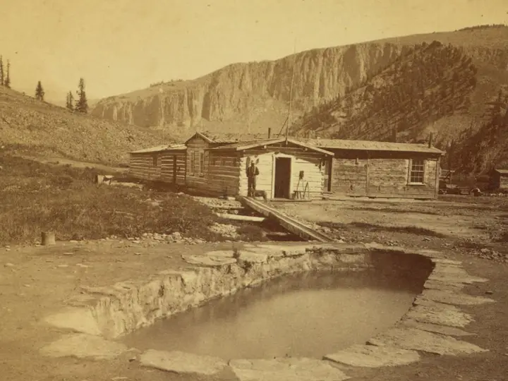
Wagon Wheel Gap Hot Springs (4UR Ranch)
Colorado, United States
12 mi away, ~20 min drive
Temp n/a Paid Drive-up
Near Pagosa Springs
Wild & natural
Near Pagosa Springs
Resort or spa
104-105°F40-41°C
Wild & natural
Nathan's Hippy Dip Hot Spring
Colorado, United States
32 mi away, ~50 min drive
104-105°F40-41°C Free Drive-up
Near Pagosa Springs
Resort or spa
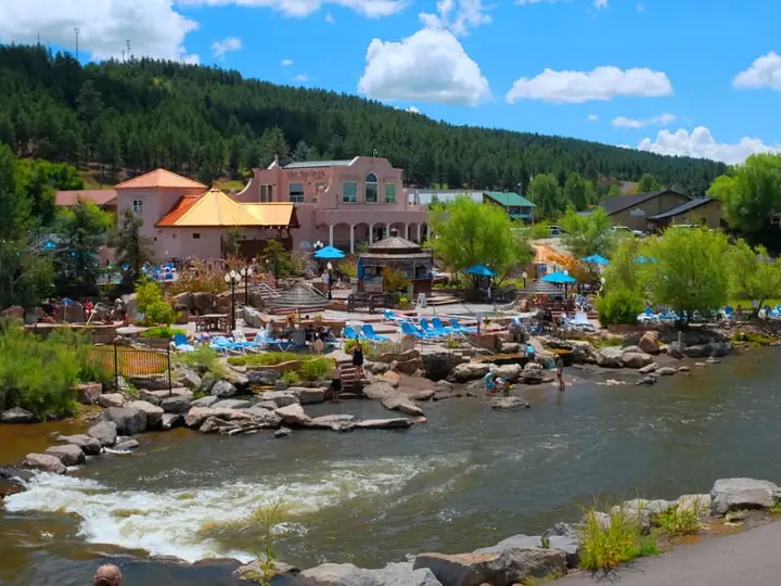
The Springs Resort, Pagosa Springs (Mother Spring)
Colorado, United States
32 mi away, ~50 min drive
101-112°F38-44°C Paid Drive-up
All hot springs in ColoradoAll hot springs in United StatesOpen the full map