Turkey Creek Hot Springs
Near Gila, New Mexico, United States
A string of hot creekside pools deep in the Gila Wilderness, reached by about 4 miles of river crossings, creek bottom and a tight scramble from the end of rough Forest Road 155 above Gila.
- Water temperature
- Not published
- Entry
- Free
- Getting in
- Long hike
- Type
- Wild & natural
- The water comes out of the ground at about 165°F74°C and is cooled by Turkey Creek, so you choose a pool or rebuild one to get the temperature right.
- The pools are spread along about a quarter mile of creek, with campsites nearby for an overnight trip.
- The route includes Gila River crossings and a rockfall that hikers call the Keyhole, where you crawl or pass packs up a ledge.
- Forest Road 155 deteriorated badly by late 2025. Its last stretch is an eroded rock shelf with steep drop-offs.
What to expect
Turkey Creek Hot Springs is a set of primitive pools along Turkey Creek, a side canyon of the Gila River, on the southern edge of the Gila Wilderness north of the small community of Gila. Nothing here is built. Hot water rises from the creek bed and the banks at about 165°F74°C, mixes with the cold creek and collects in rock-ringed pools that hikers have shaped and reshaped for decades.
The springs are spread over roughly a quarter mile of creek. Some pools are too hot, some too cool, and many need a few rocks moved before they are right. That is part of the appeal. You can usually find a pool for yourself, and the setting is a narrow, rocky canyon with no road noise at all.
This is a wilderness trip, not a roadside soak. Getting here takes a rough drive, river crossings and a rockfall scramble. Most people make it an overnight, camping near the pools and soaking in the evening and again at dawn.
Getting there
The drive. From Silver City, take US 180 northwest toward Cliff and turn off for Gila, roughly 40 miles from town. In Gila, pick up Turkey Creek Road, which becomes Forest Road 155 and climbs into the hills north of town. The road is dirt and gets worse as you go. A hiker who drove it in November 2025 described the last stretch, past Brushy Canyon, as a badly eroded bare rock shelf with steep drop-offs, slow enough that he kept under 5 mph. Horse packers on the same trip came in from the river side instead because the road was so poor. A high-clearance four-wheel-drive vehicle is the sensible choice. If you have doubts at the start of the rough section, park and walk.
FR 155 ends near the Gila River. The coordinates on this page point to the end of the road, not the springs. Do not try to drive across the river: vehicles get stranded, and the river rises fast.
The hike. From the end of the road, the route heads upstream along the Gila River, with crossings that range from knee-deep to deeper depending on the season. Near the mouth of Turkey Creek it passes an old ranch site, about 2 miles in according to one 2025 report. The land around that ranch is a private inholding, so stay on the trail and respect any signs. From there an old road turns north up Turkey Creek, crossing the creek several times, until it reaches the wilderness boundary and narrows to Turkey Creek Trail 155 on the west side of the creek.
About 2 to 3 miles in, Trail 155 switchbacks up the ridge between Turkey Creek and Skeleton Canyon. Do not follow it up the ridge. For the springs, stay in the Turkey Creek bottom. From here the route is a rough path that crosses the creek and fades in places. Years of fire and flood have wiped out sections of trail, and mesquite and brush grow over the tread.
Shortly before the springs, a big rockfall blocks the canyon. Hikers call it the Keyhole or the Crux. Depending on water and debris, you crawl through a gap in the boulders, edge around on a ledge, or hand packs up over a small waterfall. Past it, the first hot pools are about half a mile on, below a heavily used camp, with more pools and a larger camp upstream.
Total distance is about 4 miles each way, with only a few hundred feet of climbing. Allow most of a day for the round trip, or longer with a heavy pack.
When to go
Fall (October and November) is the best season. The river is usually low and the air is mild. Late spring, once snowmelt has passed, is also good. Expect more people on weekends: one November 2025 trip found many groups camped along the river on a Sunday night.
Spring runoff can make the Gila River crossings dangerous or impossible. The summer monsoon, roughly July to September, brings afternoon storms and flash floods that can turn the river and Turkey Creek brown and violent in minutes. Do not camp in the creek bed in monsoon season, and do not attempt crossings in high water. Summer days in the low canyon are hot, and a hot soak is less inviting. Winter is quiet and the soak is welcome, but cold crossings are hard on feet and the days are short.
Closures in 2026: the Gila National Forest had a busy year. The Sacaton Fire closure (from July 1, 2026) covered the northwestern Gila Wilderness, far from Turkey Creek, and has dropped off the alerts page. Monsoon flood damage closed the Ben Lilly and Willow Creek campgrounds and parts of the Catwalk trail, also elsewhere on the forest. No current order covers FR 155 or Turkey Creek, but call before you go.
Rules and etiquette
- No fee or permit. The Gila Wilderness requires no pass for private visitors. Commercial and organized groups need a permit.
- Camping limit. Gila NF order 03-06-00-25-002 allows camping for 14 days in any 30-day period (through May 18, 2027).
- Wilderness rules. No motor vehicles, bikes or other mechanized equipment past the wilderness boundary.
- Clothing. The Gila NF has no nudity order. Clothing is up to you and the people around you.
- Cannabis. A Southwestern Region order (03-00-00-21-002) bans possession on New Mexico national forests.
- Pools. Move rocks to adjust a pool if you need to, but do not dig into the banks, and leave pools usable for the next people.
- No soap in the water, and pack out everything, including toilet paper. Bury waste in a cathole well away from the creek and campsites.
- Stock feed brought into the forest must be certified weed free.
Where to stay nearby
- At the springs: established campsites sit near the pools, and there are more along the Gila River near the start of the hike. Bring a filter for river or creek water.
- Gila and Cliff: small communities at the start of the drive with limited services.
- Silver City, about 40 miles south, is the nearest town with full services, motels and gear shops.
For a developed soak on the way home, Faywood Hot Springs lies between Silver City and Deming. Farther north, the Gila Hot Springs Campground near the Gila Cliff Dwellings and the San Francisco Hot Springs near Glenwood are other options. Jordan Hot Springs, a warm pool on the Middle Fork, is the Gila Wilderness’s other classic hot spring backpack.
Safety notes
- Scalding water: the source is about 165°F74°C. Pools right below a vent can burn. Test every pool with your hand first.
- River crossings: check the Gila River level before you leave. If a crossing looks too fast or too deep, turn around. Rivers rise quickly during storms and take hours to drop.
- Flash floods: in monsoon season, camp on high ground, not in the creek bed, and watch the sky upstream.
- The Keyhole: the rockfall scramble is the hardest part of the hike. Pass packs, take your time and turn back if wet rock makes it unsafe.
- Wildlife: black bears, mountain lions and rattlesnakes live in the Gila. In spring 2026 the forest also warned of possibly rabid and aggressive animals near popular recreation areas. Store food properly and keep dogs close.
- Warm water: keep your head above water in any hot pool to avoid the Naegleria fowleri amoeba.
- No signal: there is no cell coverage in the canyon. Leave a trip plan and carry a satellite messenger.
Map and nearby springs
GPS: 33.06671, -108.49875
Turkey Creek Hot Springs: common questions
How long is the hike to Turkey Creek Hot Springs?
Plan on about 4 miles each way. Published figures run from 3 to just over 4 miles one way, with only a few hundred feet of total climbing. It feels longer than the numbers suggest, because of river crossings, overgrown sections, rocky creek bottom and a scramble through a rockfall near the springs.
How hot is Turkey Creek Hot Springs?
The source water emerges at about 165°F74°C, far too hot to touch. It mixes with creek water in the pools, so temperatures vary from pool to pool and change after every flood. Test with a hand before getting in, and never step into a pool fed directly by the source.
Do you need 4WD to reach Turkey Creek Hot Springs?
A high-clearance four-wheel-drive vehicle is the safe choice. A Silver City hiker who drove Forest Road 155 in November 2025 described the last section as a badly eroded bare rock shelf with steep drop-offs and crept along at under 5 mph. Do not try to drive across the Gila River.
Is Turkey Creek Hot Springs open in 2026?
Yes, as far as the Gila National Forest alerts show in October 2026. The Sacaton Fire closure that started July 1, 2026 covered the northwestern corner of the Gila Wilderness, not Turkey Creek, and it no longer appears on the alerts page. Call the Gila National Forest Supervisor's Office (575-388-8201) for road and river conditions before you go.
Is Turkey Creek Hot Springs clothing optional?
The Gila National Forest has no forest-wide nudity order, unlike the Santa Fe and Tonto forests. Nudity is a matter of who else is there. Bring a swimsuit, and be considerate on busy weekends.
Can you camp at Turkey Creek Hot Springs?
Yes. There are well-used campsites near the pools and along the Gila River near the start of the hike. The Gila NF limits camping to 14 days in any 30-day period. Camp well back from the creek and pack out everything.
Closest hot springs to Turkey Creek Hot Springs
101-104°F38-40°C
Resort or spa
Gila Hot Springs Campground
New Mexico, United States
19 mi away, ~30 min drive
101-104°F38-40°C Paid Drive-up
90-94°F32-34°C
Wild & natural
Near Glenwood
Wild & natural
95-110°F35-43°C
Resort or spa
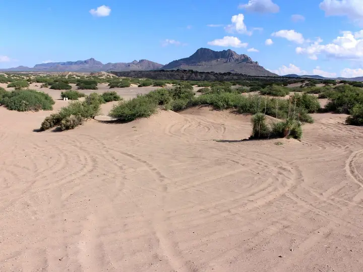
Hot Well Dunes Recreation Area
Arizona, United States
66 mi away, ~1.5 hr drive
106°F41°C Paid Drive-up
104°F40°C
Resort or spa
All hot springs in New MexicoAll hot springs in United StatesOpen the full map
Sources we checked (6)
- desertlavender.com/new-mexico/gila-wilderness/turkey-creek-2025.php
- desertlavender.com/new-mexico/gila-wilderness/turkey-creek.php
- cacreeks.com/gila.htm
- islands.com/2125171/turkey-creek-hot-springs-new-mexico-most-romantic-southwest-wilderness
- openstreetmap.org/way/14479736
- nmfireinfo.com/2026/07/01/gila-national-forest-closure-order-issued-for-sacaton-fire/