Ohanapecosh Hot Springs
Near Packwood, Washington, United States
Warm seeps on a forested bench above the Ohanapecosh River in the southeast corner of Mount Rainier National Park. A resort stood here until the 1960s; today it is a short interpretive walk, with no soaking.
Closed to the public. Soaking is not permitted. Mount Rainier National Park removed the old resort in the 1960s and says the springs do not hold enough water to bathe in without damaging the area. You can still see the seeps from the 0.4-mile Hot Springs Nature Trail. In 2026 the campground, visitor center and nature trailhead are closed for rehabilitation through November; reach the trail from the Silver Falls Trail.
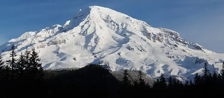
Photo: NPS Photo (Public domain). Resized and cropped for this page.

- Water temperature
- Not published
- Entry
- Paid
- Getting in
- Short walk
- Type
- Wild & natural
- No bathing allowed. The park returned the site to a natural state after the resort closed, and the seeps are too small to soak in.
- The Hot Springs Nature Trail is a 0.4-mile loop with a boardwalk over the warm runoff and signs about the old resort.
- In 2026 the Ohanapecosh campground, visitor center and nature trailhead are closed for rehabilitation through November. Walk in on the Silver Falls Trail.
- A 1984 park report measured one newly found spring at 115-120°F46-49°C, beside a river running at 43°F6°C.
What to expect
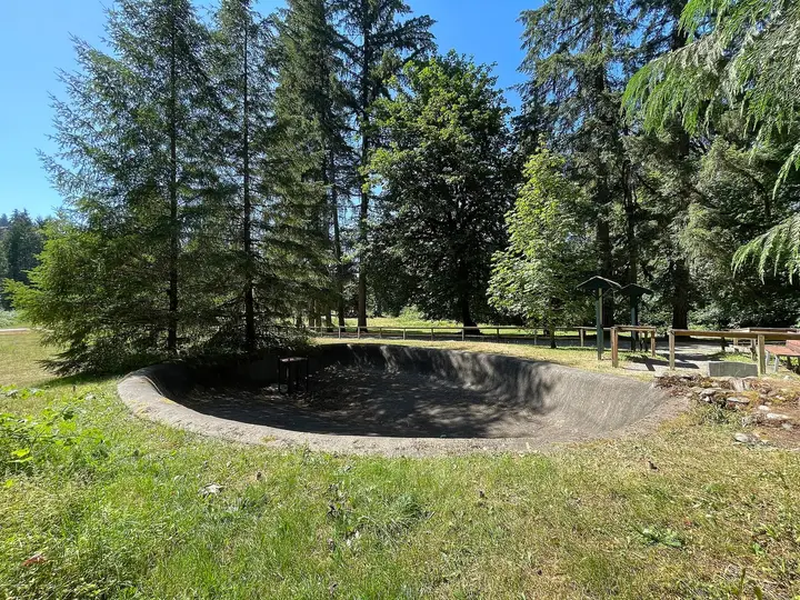
Ohanapecosh Hot Springs is not a place to soak. It is a set of small warm seeps on a forested bench above the Ohanapecosh River, in the low, old-growth southeast corner of Mount Rainier National Park. Warm water seeps out of the ground, runs across a grassy patch and drains toward the river. A boardwalk carries the Hot Springs Nature Trail over the wettest part, and signs explain what used to stand here.
Bathing is not allowed. The park’s position, stated in its own Nature Notes as far back as 1984, is that the springs do not produce enough water for anyone to bathe without major alteration of the site. Older guidebooks that described soaking here are out of date. Stay on the trail and boardwalk.
The water is genuinely hot at the source. In 1984 a ranger found a new spring on the bench running at 115 to 120°F46 to 49°C, while the river below was 43°F6°C. You will see warm runoff, mineral staining and the odd wisp of steam on a cold morning, not pools.
It is worth the stop if you are already driving SR 123 or hiking to Silver Falls. Do not make the trip expecting a soak.
History
The springs drew visitors long before the park reached them. A commercial tent camp was running at the site by about 1912. The Forest Service issued a development permit in 1921, and in 1924 a small hotel and two bathhouses were built. Dr. A. W. Bridge became sole owner in 1926, and the property sold again in 1947.
The park boundary was moved in 1932 to include the springs, and the resort carried on at a small scale. The concession contract ended on December 30, 1960, though some accounts have the resort operating until 1963. By 1967 the National Park Service had removed the buildings and let the area return to forest. The nature trail now runs past the former lodge site.
Getting there
Ohanapecosh is on State Route 123, about 3 miles north of the park’s southeast boundary and about 42 miles east of the Nisqually Entrance by park roads.
- From Packwood: Drive about 8 miles east on US 12, then turn north on SR 123 and continue about 3.5 miles to the Ohanapecosh area.
- From the Paradise side: Take Stevens Canyon Road east. Ohanapecosh sits near where Stevens Canyon Road meets SR 123.
- From the north (Enumclaw or Yakima): Come over Cayuse Pass on SR 123.
In a normal season, day-use parking is in the Ohanapecosh Campground, and the nature trail starts by the visitor center. In 2026 that does not work: the campground, visitor center, bathrooms, picnic area and amphitheater are closed for a rehabilitation project through November 2026, and the Silver Falls Trailhead inside the campground is closed too. The park says you can still reach the Hot Springs Nature Trail from the Silver Falls Trail, which you can join from Stevens Canyon Road or SR 123. It can no longer be walked as a loop from the campground this year.
The nature trail itself is a 0.4-mile loop with about 50 feet of elevation change.
When to go
The Ohanapecosh area is only reachable when SR 123 and Stevens Canyon Road are open, roughly late May to fall. In October 2026 the park listed Stevens Canyon Road as scheduled to close on October 26 and SR 123 as likely to close in mid to late November, depending on weather. Neither reopens until the snow is cleared the following spring.
Summer weekends are busy across the park, but this corner is quieter than Paradise or Sunrise. Mount Rainier does not use timed entry reservations in 2026, so you only need an entrance pass.
Rules and etiquette
- No soaking, wading or bathing in the springs or runoff.
- Stay on the trail and boardwalk. The ground around the seeps is soft and easily damaged.
- Entrance fee: $30 per private vehicle, $25 per motorcycle or $15 per person on foot or bike, each valid for seven days. The $55 Mount Rainier annual pass and America the Beautiful passes are accepted.
- No dogs on park trails.
- Do not collect rocks, plants or mineral deposits.
Where to stay nearby
- Ohanapecosh Campground normally has 185 sites and opens from late May to early October. It is closed for all of 2026 for rehabilitation, so plan on it again from 2027 and check the park site first.
- Packwood, about 11.5 miles away via SR 123 and US 12, is the closest town, with motels, cabins, a few restaurants and fuel.
- The lodges at Longmire and Paradise, on the west side of the park, are the nearest in-park rooms; check which park campgrounds are open before you go. Longmire also has historic mineral springs of its own, which are a viewing stop rather than a soak.
Safety notes
- Hot water: Some seeps run well above body temperature. Keep hands and feet out of them.
- Footing: The boardwalk and forest trail can be slick with rain, moss and leaves.
- Wildlife: Black bears and elk use this valley. Keep food in your car, not on picnic tables.
- Old-growth hazards: Big trees drop limbs in storms. Avoid the forest in high wind.
- Grove of the Patriarchs: The popular trail across the river has been closed since a November 2021 flood damaged its suspension bridge. Bridge replacement is not expected to start before 2027. Respect the closure signs.
Nearby stops worth adding
Silver Falls is the natural pairing. The Silver Falls Trail follows the Ohanapecosh River to a waterfall that drops into a narrow gorge, and in 2026 it is also your route to the hot springs. Box Canyon, a short drive west on Stevens Canyon Road, has a deep, narrow slot where the Muddy Fork runs far below a bridge; it has no potable water or flush toilets in 2026. Farther up Stevens Canyon Road, Reflection Lakes is about 19 miles west of Ohanapecosh.
Map and nearby springs
GPS: 46.73734, -121.56258
Ohanapecosh Hot Springs: common questions
Can you soak in Ohanapecosh Hot Springs?
No. Mount Rainier National Park does not permit bathing at Ohanapecosh. The park has said there is not enough water to bathe in without major changes to the site, and the old resort pools were removed by 1967. The springs are now a viewing stop on a nature trail.
Where are the hot springs at Ohanapecosh?
On a forested bench above the Ohanapecosh River, next to the Ohanapecosh Visitor Center and campground on State Route 123, about 3 miles north of the park's southeast boundary. The Hot Springs Nature Trail loops through the area.
Is the Ohanapecosh Hot Springs trail open in 2026?
The trail itself can be walked, but its usual trailhead is closed in 2026 because the campground, visitor center, bathrooms and picnic area are shut for a rehabilitation project through November 2026. The park says you can reach it from the Silver Falls Trail, which can be hiked from Stevens Canyon Road or SR 123, though not as a loop from the campground.
Was there a resort at Ohanapecosh?
Yes. A tent camp was operating by about 1912, a small hotel and two bathhouses went up in 1924, and the park boundary was moved to take in the springs in 1932. The concession contract ended on December 30, 1960, and by 1967 the National Park Service had removed the buildings.
Where can you soak near Mount Rainier?
Not inside the park. The nearest public soaks are well outside it, so most people pair an Ohanapecosh visit with hiking rather than bathing. Elsewhere in Washington, Goldmyer Hot Springs near North Bend and Sol Duc Hot Springs Resort in Olympic National Park both allow soaking.
Closest hot springs to Ohanapecosh Hot Springs
104-111°F40-44°C
Resort or spa
Goldmyer Hot Springs
Washington, United States
52 mi away, ~1.5 hr drive
104-111°F40-44°C Paid Long hike
Near Klickitat
Wild & natural
Near Carson
Wild & natural
Near Skykomish
Resort or spa
All hot springs in WashingtonAll hot springs in United StatesOpen the full map