Coyote Hot Spring (Prince Albert Hot Springs)
Near Glenns Ferry, Idaho, United States
A small, rarely busy hot spring in the Bennett Mountain Hills north of Glenns Ferry, listed in the federal thermal springs inventory as Coyote Hot Spring and known to soakers as Prince Albert Hot Springs.
- Water temperature
- 100-109°F38-43°C
- Entry
- Free
- Getting in
- Hike in
- Type
- Wild & natural
- The federal thermal springs list places "Coyote Hot Spring" at the same spot as the soak most people call Prince Albert Hot Springs.
- Two small pools. The upper one is built of stone and cement and holds about five people.
- Free, on BLM land, with no facilities. Primitive camping is possible near the upper pool.
- Most cars stop at the BLM gate. From there it is a steep walk of 1.5 to 2 miles.
What to expect
Coyote Hot Spring is the name under which this spring appears in the federal inventory of thermal springs, which plots it in the Bennett Mountain Hills of Elmore County. Almost nobody uses that name on the ground. The spring at those coordinates is the one soakers call Prince Albert Hot Springs, and that is the name you will see in most trip reports and maps. If you are looking for it, search for both. (There is also a separate, ordinary cold spring named Coyote Spring about 2.5 miles to the west on the same USGS map. It is not a hot spring.)
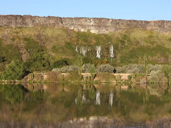
The spring sits in dry, open sagebrush hills north of the Snake River at about 4,100 feet. Hot water comes out of the ground at roughly 130°F54°C and feeds two small pools.
- The upper pool is built of stone and cement and holds up to about five people.
- The lower pool is smaller, with room for two to four. An older report described the lower soak as a long metal trough.
Locals have rigged PVC pipes so the pools can be drained and refilled with fresh water from the source. Pool temperatures run about 100-109°F38-43°C, depending on how long the water has sat. There is a slight sulfur smell.
It is a quiet place. Usage is low, and on a weekday you may well have it to yourself. It is also clothing optional by custom, so be ready for that if someone else is there.
There are no facilities of any kind: no toilet, no drinking water, no shade structures and no trash cans.
Getting there
The spring is roughly 16 miles north of Glenns Ferry. The route follows rural roads that are fine when dry and a real problem when wet. One directory gives these directions:
- From I-84, take Exit 120 at Glenns Ferry and head north.
- Turn onto the Old Oregon Trail Road and follow it about 3.9 miles to Bennett Mountain Road.
- Bear right onto Bennett Mountain Road and drive about 6.5 miles to Alkali Road.
- Turn left on Alkali Road and go about 2.8 miles to a fork.
- Bear right and continue about 0.4 miles to a BLM gate, where public land begins.
RVs, trailers and two-wheel-drive vehicles should park at the gate. From there the spring is about 1.5 to 2 miles farther up a steep, rough track. High-clearance 4WD vehicles with experienced drivers can go on, but nobody should try it when the ground is wet or snowy. Most people walk.
The walk is steep and exposed, with no shade. Bring plenty of water, a hat and sturdy shoes. A creek runs across the road on the way in, and after rain it can wash out the road or flood the crossing.
Carry a paper map or downloaded directions. Coverage is reported to be decent on the major networks, but do not count on it.
When to go
Late spring and early fall are the best windows. The roads are usually dry, and the air is cool enough that a hot soak feels good.
Summer is possible, but the hills get very hot on sunny days, and the walk from the gate is fully exposed. Go early in the morning or near sunset.
Winter and wet weather usually rule it out. Rain and snow turn the roads to mud, and the creek crossing can flood. A visitor in January turned back at water running over the road.
Insects are part of the picture here. Mormon crickets can swarm the roads in some years, and snakes are around in warm weather. Watch where you step and sit.
Rules and etiquette
The spring is on Bureau of Land Management land. There is no fee and no posted hours.
- Respect the gate. Do not drive past it unless your vehicle and the conditions are right, and never block it.
- No soap or shampoo in the pools, including biodegradable products.
- Drain and refill thoughtfully. If you drain a pool to clean it, refill it before you leave so the next visitor has a soak.
- Clothing is optional by custom.
- Pack out everything, including trash left by others if you can.
- Fire safety: The surrounding sagebrush burns easily. Check BLM fire restrictions before using the fire ring, and never leave a fire unattended.
Where to stay nearby
- Primitive camping: You can camp on BLM land near the springs, including beside the fire ring at the upper pool. It is cowboy camping only, with no toilets or water. Bring everything, including extra water.
- Glenns Ferry: The closest town, with basic services. Three Island Crossing State Park on the edge of town has a campground on the Snake River and is a comfortable base for the drive in.
- Mountain Home and Twin Falls: Mountain Home is the nearest larger town to the west along I-84. Twin Falls, roughly 75 miles away, has the widest range of hotels.
Safety notes
- Heat: The source is about 130°F54°C. When refilling a pool, let it cool and test it with your hand before getting in.
- Dehydration: The walk is steep, dry and shadeless. Carry more water than you think you need, especially in summer.
- Road conditions: Mud can strand a vehicle on these roads. If rain is forecast, do not go, and if it starts raining while you are there, leave early.
- Wildlife: Rattlesnakes are possible in warm months. Watch your footing on the trail and around rocks.
- Remoteness: This is a lightly used area. Tell someone your plans, carry a spare tire and basic recovery gear, and do not count on another vehicle coming by.
Nearby stops worth adding
Prince Albert Hot Springs is another name for this same spring, so there is no second stop to plan. Back near I-84, Three Island Crossing State Park marks one of the best known river crossings on the Oregon Trail and has an interpretive center. If you want a developed soak on the same trip, the commercial springs of the Hagerman Valley, such as Miracle Hot Springs and 1000 Springs Resort, are less than an hour east. Banbury Hot Springs in the same valley has been temporarily closed since October 2022, so check before you go.
Map and nearby springs
GPS: 43.12933, -115.33887
Coyote Hot Spring (Prince Albert Hot Springs): common questions
Are Coyote Hot Spring and Prince Albert Hot Springs the same place?
As far as we can tell, yes. The federal thermal springs list, reproduced by Idaho hot springs guides, places Coyote Hot Spring at about 43.129, -115.34 on the Bennett Mountain map. That matches the coordinates published for Prince Albert Hot Springs. A separate cold spring named Coyote Spring sits about 2.5 miles to the west.
How do you get to Coyote (Prince Albert) Hot Spring?
From I-84 at Glenns Ferry, head north on the Old Oregon Trail Road, then Bennett Mountain Road and Alkali Road to a fork and a BLM gate, a drive of roughly 14 miles on rural roads. Most vehicles park at the gate. The last 1.5 to 2 miles is a steep walk or a rough 4WD track.
How hot is Coyote Hot Spring?
The source is about 130°F54°C. The pools are usually 100-109°F38-43°C, depending on how recently they were drained and refilled and how much the water has cooled.
Can you camp at Prince Albert Hot Springs?
Primitive camping is possible on BLM land near the springs, including beside a fire ring at the upper pool. There are no toilets, water or trash service. Check BLM fire restrictions in summer.
Can you reach the spring in winter?
Usually not. Rain and snow turn the access road to mud, and a creek that crosses it can wash it out. One visitor in January turned back at a flooded crossing. Plan for late spring to fall.
Closest hot springs to Coyote Hot Spring (Prince Albert Hot Springs)
90-108°F32-42°C
Resort or spa
101°F38°C
Public pool
96-106°F36-41°C
Resort or spa
89-104°F32-40°C
Resort or spa
90-105°F32-41°C
Wild & natural
All hot springs in IdahoAll hot springs in United StatesOpen the full map