Big Caliente Hot Springs
Near Santa Barbara, California, United States
A concrete and rock soaking pool fed by 115°F64°C spring water in the Santa Ynez River backcountry behind Santa Barbara, reached by long dirt forest roads and closed by the Forest Service until at least September 2027.
Temporarily closed. Forest Order 05-07-54-26-09 closes the Big Caliente Picnic Area, where the pools are, and bars motor vehicles from Big Caliente Road (5N16) and Romero-Camuesa Road from September 16, 2026, to September 15, 2027, after storm damage. Call the Santa Barbara Ranger District at 805-967-3481.
- Water temperature
- 115°F46°C
- Entry
- Free
- Getting in
- 4WD road
- Type
- Wild & natural
- Closed: entering the Big Caliente Picnic Area is prohibited under a Forest Order running to September 15, 2027.
- Spring water leaves a bluff at about 115°F46°C, and valves let you adjust the flow into the main pool.
- The route crosses the Santa Ynez Mountains and drops into the upper Santa Ynez River valley on unpaved clay roads.
- Pendola Station, built in 1934, sits on Big Caliente Road below the springs.
Current status: closed
Big Caliente Hot Springs is closed. Forest Order 05-07-54-26-09, signed by the Los Padres National Forest supervisor on September 15, 2026, prohibits entering or using the Big Caliente Picnic Area, the developed day-use site where the pools are. The order runs from September 16, 2026, through September 15, 2027, and replaces a similar order from September 2025.
The same order closes several nearby sites, including Lower Caliente Campground (the small camp just below the springs, which appears to be the site long known as Rock Camp), Little Caliente Picnic Area, Mono Campground, P-Bar Flat Campground and Middle Santa Ynez Campground. One section of Romero-Camuesa Road (5N15.3) is closed to everyone, and Big Caliente Road (5N16), Little Caliente Road and other sections of Romero-Camuesa Road are closed to motor vehicles. Violations can bring a fine of up to $5,000 for an individual, six months in jail, or both.
The Forest Service explains that record storms in 2023 and 2024 badly damaged roads and sites in this part of the forest. In its 2026 notes for campground concessionaires, it lists Big Caliente Picnic Area as one of four Santa Barbara Ranger District sites that need deferred maintenance before reopening: brushing, hazard tree removal, repairs to site amenities and access road work. As of that update, surveys and clearances for the work were still pending, so there is no reopening date.
Before you plan anything, call the Santa Barbara Ranger District at 805-967-3481. The office answers Monday to Friday, 10 am to noon and 1 to 3 pm. The rest of this page describes the springs as they were when open, so you know what to expect when the order is lifted.
What to expect
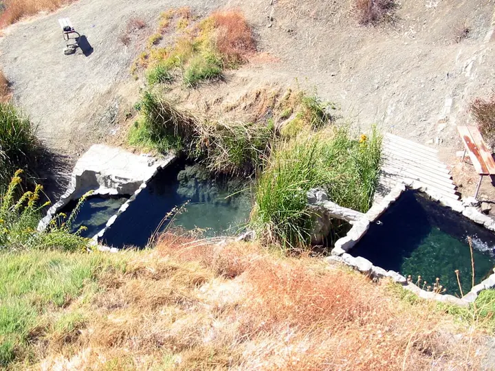
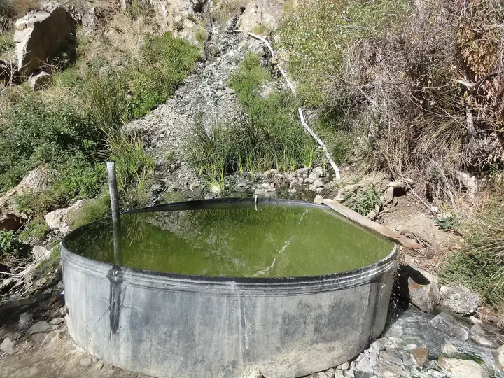
Big Caliente sits at about 1,440 feet in Agua Caliente Canyon, in the backcountry north of the Santa Ynez Mountains. The spring water comes out of a bluff at about 115°F46°C and runs into a large, deep soaking pool built from rock and concrete. Diversion valves control how much hot water enters the pool, so soakers can bring the temperature up or down. Below the source, beside the creek, is a second, more primitive pool, and Wikipedia notes a third pool across the creek fed by a separate hot spring.
This is a developed but unstaffed site: a pool next to a small parking area at the end of a long dirt road. The water is rich in soda compounds. Because it was reachable by car, Big Caliente was well known locally and could be busy on weekends.
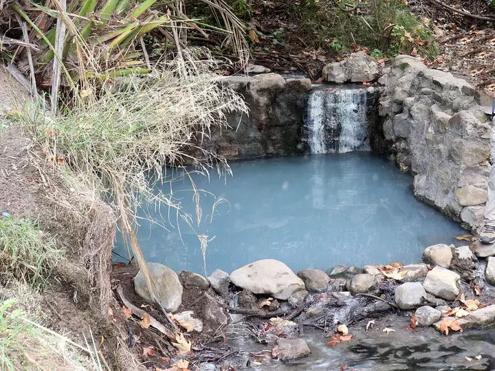
Little Caliente Hot Springs, a smaller set of rock-lined pools about 105°F41°C to the west near Mono Campground, is also closed under the same order.
Getting there (when it reopens)
The usual route is from Santa Barbara over the Santa Ynez Mountains.
- Take Gibraltar Road from the foothills behind Santa Barbara up to the crest, where it meets East Camino Cielo. Turn right.
- Follow East Camino Cielo along the ridge to Romero Saddle, where the pavement ends and the road becomes Romero-Camuesa Road.
- Drop down Romero-Camuesa Road toward the Santa Ynez River, crossing near Juncal Dam and passing P-Bar Flat and Middle Santa Ynez campgrounds.
- At the signed junction, turn onto Big Caliente Road and climb Agua Caliente Canyon past Pendola Station to Lower Caliente Camp. The springs are a short way beyond, where the road ends.
Sources put the drive at about an hour and a half from Santa Barbara. The roads past Romero Saddle are more than 8 miles of adobe clay that turns dangerously slippery when wet. Wikipedia recommends a high-clearance four-wheel-drive vehicle or a motorcycle, and the road has washed out more than once. Even before the current order, the Forest Service closed the gate before and during rain, sometimes for several days, leaving a long hike or bike ride as the only way in.
When to go
For now, you cannot go. When the site reopens, the best visits will be on dry days in spring and fall, after the road has had time to firm up following rain. Summer in the inland Santa Ynez valley is hot, which makes a 115°F46°C soak less appealing at midday. Weekdays are quieter than weekends.
Watch the forecast closely. Gates on this road system are shut ahead of storms, and closures can come with little notice. Check the Los Padres National Forest alerts page and call the district the day before you go.
Rules and etiquette
- Closed now. Entering the Big Caliente Picnic Area is prohibited until the Forest Order expires or is lifted.
- When open, it is day use only. Camping is not allowed at the springs. The nearest camp was Lower Caliente, which is also closed under the current order.
- Fire rules. Los Padres fire restrictions ban fires outside designated campfire sites, and campfires are prohibited year-round in the Santa Barbara front country. A free California campfire permit is required for stoves outside developed recreation sites.
- No soap or shampoo in the pool, and pack out all trash.
- Clothing is not regulated by any posted rule we could find. Expect a mix.
Where to stay nearby
Santa Barbara, on the coast, has the full range of hotels, motels and inns, and is the starting point for the drive. For camping, the Forest Service and its concessionaire run campgrounds in the Lower Santa Ynez Recreation Area, reached from Highway 154, including Fremont and Los Prietos campgrounds. Reservations are made on Recreation.gov. Day-use parking in that area costs $10 a day. River Road, at the upper end of the recreation area, has had limited access because of storm damage, so check conditions before relying on it.
Safety notes
- Hot water: The source runs at about 115°F46°C, hot enough to scald. Adjust the valves, test the water with your hand, and keep soaks short.
- Roads: Clay roads become impassable and dangerous after rain. Do not drive them wet, and do not try to get around a closed gate.
- Remoteness: There is no cell service to count on and no services beyond Santa Barbara. Carry water, food and a full tank, and tell someone your plans.
- Backcountry hazards: Poison oak, ticks and rattlesnakes are common in the Los Padres backcountry. Stay on cleared ground.
- Water quality: Do not put your head under the water.
History
The Chumash were the first known users of the springs. George Owen Knapp, who built the mountain retreat now known as Knapp’s Castle and helped build East Camino Cielo Road, built the first cement pool and a cabin at Big Caliente. Pendola Station on Big Caliente Road dates from 1934, and the ruins of the Pendola family’s ranching adobe stand beside it.
Map and nearby springs
GPS: 34.53922, -119.56460
Big Caliente Hot Springs: common questions
Is Big Caliente Hot Springs open?
No. As of October 2026, Forest Order 05-07-54-26-09 prohibits entering the Big Caliente Picnic Area, which holds the pools. The order runs from September 16, 2026, to September 15, 2027, and also closes Big Caliente Road and Romero-Camuesa Road to motor vehicles. It replaced a similar 2025 order.
Why is Big Caliente closed?
The Forest Service says record winter storms in 2023 and 2024 heavily damaged access roads and sites. It lists Big Caliente Picnic Area among Santa Barbara Ranger District sites that need deferred maintenance, including brushing, hazard tree work, amenity repairs and access road repairs, before they can reopen.
How hot is Big Caliente Hot Springs?
The water comes out of a bluff at about 115°F46°C and runs into a large, deep pool of rock and concrete. Diversion valves let soakers control how much hot water enters, so the pool temperature varies.
Can you hike to Big Caliente while the road is closed?
Not legally to the springs. The order closes the developed site itself, not just the roads, and violations can bring a fine of up to $5,000. Check with the Santa Barbara Ranger District before planning any trip in the area.
How do you get to Big Caliente Hot Springs when it is open?
From Santa Barbara, take Gibraltar Road up to East Camino Cielo, follow it to Romero Saddle where the pavement ends, then take Romero-Camuesa Road down to the Santa Ynez River and turn up Big Caliente Road past Pendola Station. Sources put the drive at about 1.5 hours, on clay roads that turn slick when wet.
Closest hot springs to Big Caliente Hot Springs
Little Caliente Hot Springs
California, United States
3 mi away, ~10 min drive
105-109°F41-43°C Free Long hike
Near Montecito
Wild & natural
98-105°F37-41°C
Resort or spa
Willett Hot Springs
California, United States
29 mi away, ~45 min drive
100-103°F38-39°C Paid Long hike
Near Ojai
Wild & natural
All hot springs in CaliforniaAll hot springs in United StatesOpen the full map
Sources we checked (6)
- fs.usda.gov/r05/lospadres/alerts/special-closure-sbrd-storm-damage-recovery-0
- fs.usda.gov/r05/lospadres/projects/campground-concessionaire-operations
- fs.usda.gov/r05/lospadres/conditions
- en.wikipedia.org/wiki/Big_Caliente_Hot_Springs
- songsofthewilderness.com/2016/12/28/trail-quest-big-caliente-hot-springs/
- hikelospadres.com/rocky-campground.html