Shower Bath Hot Springs
Near Challis, Idaho, United States
Hot water sprays from cracks in a canyon wall above Warm Springs Creek and runs down the rock into a string of small pools, deep in the Frank Church-River of No Return Wilderness.
- Water temperature
- Not published
- Entry
- Free
- Getting in
- Long hike
- Type
- Wild & natural
- Hot water spills down the cliff face, so you can stand under it like a shower before dropping into the pools below.
- The shortest route is Mahoney Creek Trail #4121, 4.5 miles from Sleeping Deer Road to Warm Springs Creek, then a wade up the creek.
- The last stretch passes through the Narrows, a slot where the creek fills the canyon floor and you walk in the water.
- Only two small campsites sit near the springs, plus a couple more on an island in the warm outflow.
What to expect
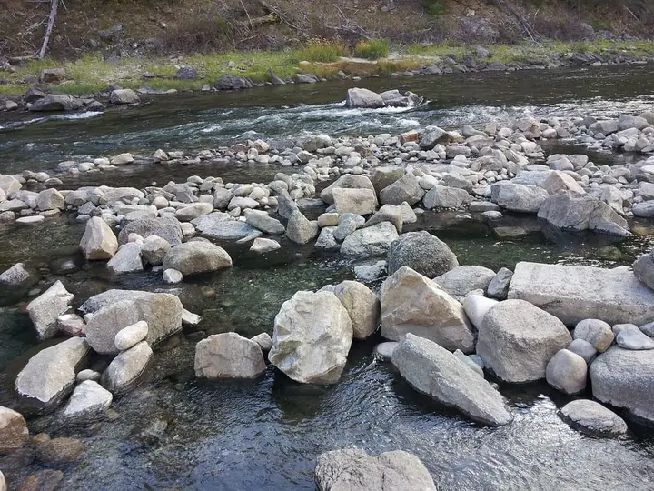
Shower Bath Hot Springs takes its name from the way the water arrives. Hot water forces its way out of cracks in the canyon wall above Warm Springs Creek and runs down the face of the rock, so in places you can stand under a warm stream as if it were a shower. Below the wall, the water collects in a series of small pools, most rimmed with stacked rock and floored with sand, gravel or bedrock. Overflow drains into a warm side channel that joins Warm Springs Creek.
The pools vary in size and temperature, so you move around until you find one you like. We could not find a reliable measured temperature for any of them. The water is clear and visitors have noticed no smell.
This is one of the most remote soaks in Idaho. It sits deep in the Frank Church-River of No Return Wilderness, in the Salmon-Challis National Forest, with no road access, no facilities and very few visitors. A long-running Idaho hot springs site rated it A+, and the reviews make clear why: big canyon walls, a creek running through a rock slot, and the odds of having the place to yourself. The same reports list snakes, black bear, deer, elk, moose and mountain lion seen in the area.
The Forest Service spells the name as one word, Showerbath, and OpenStreetMap labels it “Show Bath”. All of these are the same springs.
Getting there
Both approaches start at the end of high, unpaved forest roads that are snow-free for only about two to three months a year. Get current road and trail conditions from the Salmon-Challis National Forest before you leave. The Supervisor’s Office in Salmon is at 208-756-5100.
Mahoney Creek route (shortest). Mahoney Creek Trail #4121 starts at a junction with Sleeping Deer Road #086 and runs 4.5 miles to Warm Springs Creek Trail #4104. The Forest Service notes that this is the way to Showerbath Hot Springs and that it requires wading Warm Springs Creek. Trail apps put the full trip at about 11.6 miles round trip with roughly 2,600 feet of elevation gain, which mostly comes on the climb back out. Treat those figures as estimates and carry a map.
Loon Creek and Warm Springs Creek route (long). The Loon Creek Trail #4101 ends at the Phillips Creek Trailhead at the end of Loon Creek Road #007. A 2003 trip report followed Loon Creek past Upper Loon Hot Springs and the Owen Cabin, then turned up Warm Springs Creek past Triple Creek Hot Springs, the old Warm Springs Ranger Cabin and another set of warm springs. That trip had eight stream fords. It is a multi-day backpack, not a day hike. Far downstream, near the Middle Fork of the Salmon, the same creek has Lower Loon Creek Hot Spring, which most people reach on a river trip.
The Narrows. Whichever way you come, the final quarter mile before the springs runs through a section called the Narrows. The creek fills the canyon floor between rock walls, so there is no bank to walk on. You wade. On a hot day it is a welcome cool-down. In high water it is not safe.
Warm Springs Creek Trail #4104 itself runs 21.5 miles from Twin Peaks Lookout on Sleeping Deer Road to Loon Creek, so read the junction signs carefully.
When to go
Late August and September are the usual best months. The creek has dropped enough to wade the Narrows comfortably, and the trailhead roads are open.
July can work, but snowmelt may still run high. The Forest Service specifically warns against the route in high water.
October is possible in some years, until snow closes the high roads. Depending on which approach you take, the roads are typically open from July to October, sometimes into November, or only from August to September.
Winter and spring are effectively out of reach.
Rules and etiquette
- Wilderness regulations apply. No motor vehicles or mechanized equipment, and group size and stock rules follow Frank Church Wilderness regulations.
- No soap in the hot springs. The Forest Service is blunt about this one, and that includes biodegradable soap and shampoo.
- Leave No Trace. Pack out all trash, camp on durable ground, and bury human waste well away from water.
- Clothing: We found no posted clothing rule for this spring. It is remote, and visitors are few. Be considerate if another party arrives.
- Fires: Check current fire restrictions for the Salmon-Challis National Forest before you light one.
There is no fee and no permit listed for hiking in.
Where to stay nearby
- At the springs: two small campsites, each with room for one or two tents, sit among thorny brush and tall grass near the pools. A 2003 report also found two sites on an island formed by the warm outflow channel. Arrive with a backup plan if they are taken.
- At the trailheads: for the Loon Creek route, a 2003 party camped the night before at Tin Cup Campground near the Phillips Creek trailhead.
- Towns: Challis is the nearest town with full services, a long drive from either trailhead. Fill up there.
Safety notes
- Creek wading: The Narrows and the Warm Springs Creek crossings are the main hazard. Turn back if the water is fast or above your knees.
- Remoteness: The Forest Service warns that phones usually have no service here and that help is not readily available. Carry a satellite messenger, a first aid kit and enough food for delays.
- Trail condition: The Forest Service notes that a designated trail is not necessarily maintained or passable. Expect downed trees, and carry a saw and shovel as the Forest Service suggests.
- Wildlife: Black bear and mountain lion have been seen in the area. Store food properly. Watch for snakes on warm rocks.
- Hot water: Test each pool before you get in. The water coming off the wall can be hotter than the pools below.
Why it is worth the effort
Most Idaho hot springs are either roadside or a short walk from a campground. Shower Bath is neither. It takes planning, low water and a strong pair of legs. In return you get a canyon soak with water running down the rock above you and, most of the time, no one else around.
Map and nearby springs
GPS: 44.62431, -114.60032
Shower Bath Hot Springs: common questions
Where is Shower Bath Hot Springs?
On Warm Springs Creek in the Frank Church-River of No Return Wilderness, in the Salmon-Challis National Forest, northwest of Challis. OpenStreetMap places the springs at about 44.624 N, 114.600 W, in Custer County.
How do you hike to Shower Bath Hot Springs?
The usual route is Mahoney Creek Trail #4121, which runs 4.5 miles from Sleeping Deer Road #086 down to Warm Springs Creek Trail #4104. From there you wade up Warm Springs Creek to the springs. Trail apps put the whole trip at about 11.6 miles round trip with roughly 2,600 feet of climbing on the way out. A much longer approach comes up Loon Creek and Warm Springs Creek from the Phillips Creek Trailhead.
Do you have to wade to reach Shower Bath Hot Springs?
Yes. The Forest Service says you must wade Warm Springs Creek to reach the springs and should avoid high water. The final quarter mile runs through a narrow slot called the Narrows, where there is no bank and you walk in the creek.
When is the best time to visit Shower Bath Hot Springs?
Late summer and fall. The roads to the trailheads are only open for a short window each year, roughly July to October depending on the approach, and the creek needs to be low enough to wade safely. Late August and September are the usual sweet spot.
Can you camp at Shower Bath Hot Springs?
Yes, but space is tight. There are two small sites near the springs with room for one or two tents each, and an island formed by the warm outflow has two more. Follow wilderness rules and Leave No Trace.
Closest hot springs to Shower Bath Hot Springs
Wild & natural
Loon Creek Hot Springs (Lower Loon Creek)
Idaho, United States
16 mi away, ~25 min drive
Temp n/a Paid Boat access
96-105°F36-41°C
Public pool
Near Stanley
Wild & natural
Cove Creek Hot Springs (Kem Hot Springs)
Idaho, United States
27 mi away, ~40 min drive
Temp n/a Free Short walk
95-104°F35-40°C
Wild & natural
Wild & natural
All hot springs in IdahoAll hot springs in United StatesOpen the full map
Sources we checked (6)
- fs.usda.gov/r04/salmon-challis/recreation/trails/mahoney-creek-trail-4121
- fs.usda.gov/r04/salmon-challis/recreation/trails/warm-springs-creek-trail-4104
- fs.usda.gov/r04/salmon-challis/recreation/trails/loon-creek-trail-4101
- idahohotsprings.com/destinations/shower_bath/index.htm
- openstreetmap.org/node/7820221208
- alltrails.com/trail/us/idaho/show-bath-hot-springs-via-mahoney-creek-trail