Lone Palm Hot Spring
Near Boulder City, Nevada, Arizona, United States
A small hot spring in a side canyon of Black Canyon, above the Colorado River below Hoover Dam, reached by an unmarked 4.3-mile round-trip scramble from Kingman Wash or by paddling.
- Water temperature
- Not published
- Entry
- Paid
- Getting in
- Hike in
- Type
- Wild & natural
- The National Park Service rates the route strenuous: 4.3 miles round trip, about 1,100 feet of elevation change and hand-and-foot scrambling over rock ledges.
- The route is unmarked and unmaintained. The park notes two main lines, one of which needs ropes and climbing gear.
- Parking is free at US 93 Exit 2 (Kingman Wash Road), but you still need a Lake Mead entrance pass.
- Sandbag pools are not allowed. Past park testing found fecal bacteria when the water was dammed up.
What to expect
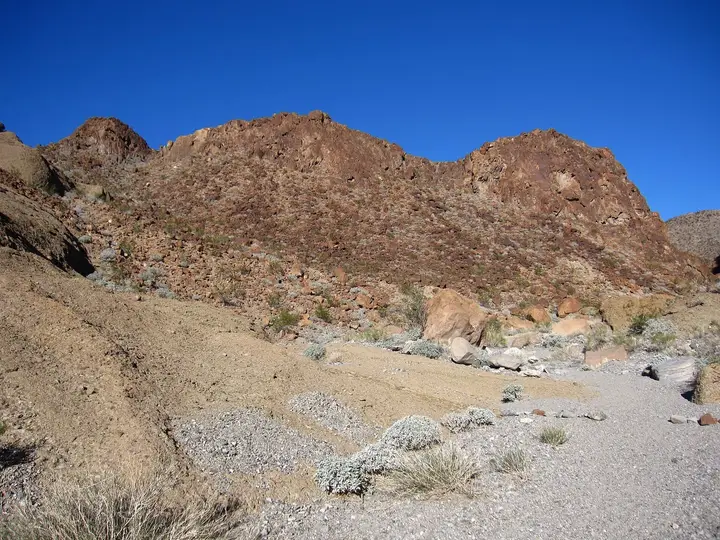
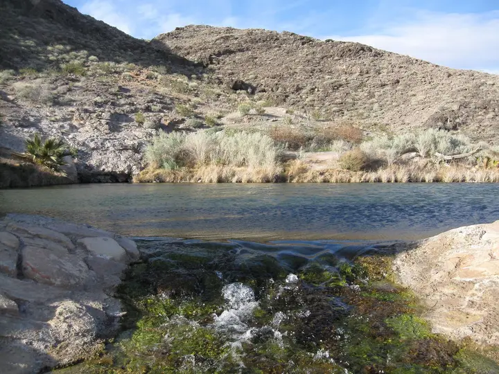
Lone Palm is one of the Arizona-side hot springs in Black Canyon, the narrow stretch of the Colorado River below Hoover Dam that is managed as part of Lake Mead National Recreation Area. The water seeps out of the canyon rock and runs down a side drainage toward the river. As at the other Black Canyon springs, wet rock along the flow grows mats of algae and ferns that look out of place in such a dry, dark volcanic landscape. The name comes from a palm growing near the river, and a few more palms grow in the area now.
Do not expect a built pool. The park’s position is that the springs should flow as they naturally do. People have stacked sandbags here in the past to make a soaking hole, and one hiker who visited in 2017 and again in 2020 found that the sandbags had gone by the second trip. Whatever you find on the day is whatever the last flash flood and the last visitors left behind.
Hard numbers are scarce. The National Park Service does not publish a temperature or flow rate for Lone Palm, and we have not found a reliable measurement, so this page leaves the temperature out. Expect warm to hot water and test it with a hand first.
The bigger draw for many people is the route itself. It is a rough, unmarked scramble through washes and over rock ledges, ending at a viewpoint over the Colorado River, and it starts a short drive north of the better-known Arizona Hot Springs trailhead.
Getting there
The trailhead is on the Arizona side of the river, a short drive south of Hoover Dam.
- From Las Vegas or Boulder City: Take I-11 and US 93 east over the Mike O’Callaghan-Pat Tillman Memorial Bridge into Arizona. Leave US 93 at Exit 2, Kingman Wash Road. The park lists free parking there. The map pin on this page marks the end of the Kingman Wash access road, where most hikers start.
- From Kingman: Drive north on US 93 toward Hoover Dam and take the same exit.
The National Park Service gives the route as 4.3 miles round trip with about 1,100 feet of elevation change, rated strenuous, and suggests allowing 4 to 8 hours. It is unmarked and not maintained. Most of it follows two normally dry washes full of soft sand, gravel and boulders, with steep grades and rock ledges to climb down on the way in and back up on the way out. The park describes two main lines: one needs ropes and rock climbing gear, the other goes up and over several large hills. Parts of the route are hard to pick out, so carry a downloaded map or GPS track and check it often.
By water: Lone Palm sits on the Black Canyon National Water Trail. Launching at the base of Hoover Dam (river mile 64) requires going through a permitted outfitter, which buses you into the dam security zone. You can also put in at Willow Beach (river mile 52.5), about 14 miles south of the dam, and paddle upstream. Motorized boats and personal watercraft are banned between the dam and Willow Beach on Sundays and Mondays all year, and horsepower limits apply on other days outside summer, so the river is quieter than you might expect. Boy Scout Hot Springs and Arizona Hot Springs are on the same stretch.
When to go
The hiking window is the cool season. Lake Mead NRA closes the Lone Palm trail, along with Arizona Hot Springs, Goldstrike Canyon, White Rock Canyon, Liberty Arch and Sugar Loaf, every year from May 15 to September 30. It also closes them on shorter notice outside those dates when the forecast for Willow Beach reaches 95°F35°C or more, or when flash floods are possible. Check the park’s current conditions page on the morning you go.
November through March is the realistic season. Even then, the dark rock heats up fast in the sun. The park notes that at an air temperature of 85°F29°C the ground can reach about 135°F57°C. Start early so you are climbing back out before the warmest part of the day.
Avoid the washes when thunderstorms are around. The route runs through drainages that can flood with little warning.
Rules and etiquette
- Pass required. The trail is in the park’s fee area. Entry is $25 per vehicle for 1 to 7 days, $15 per person on foot or bike, or $45 for an annual park pass. America the Beautiful passes work. The park has been cashless since January 2024, and there is no fee booth at Kingman Wash, so buy a pass online or at an entrance station first.
- No sandbag pools. Do not dam, dig or redirect the spring. The park says pooled water has tested high for fecal coliform, E. coli and enterococci.
- Pack out human waste. There are no toilets at the trailhead or on the trail. The park asks hikers to carry WAG bags.
- Leave rocks, plants and artifacts. Removing them is illegal on federal land.
- Clothing. There is no posted rule specific to Lone Palm. Dress for a remote canyon you may share with other hikers or paddlers.
- Groups. Parties of more than 20 need a park permit.
Where to stay nearby
- Willow Beach, on the Arizona shore about 14 miles south of Hoover Dam, has a campground and RV park, a marina with kayak and canoe rentals, a store and a restaurant.
- Backcountry camping is allowed in the park for up to 14 days under the Superintendent’s Compendium. Vehicle camping has to be at least a quarter mile from any spring, and backpack camping is not allowed within half a mile of a designated road.
- Boulder City, Nevada, back across the bridge, is the closest town for motels, food and fuel. Las Vegas has everything else.
Safety notes
- Heat. This is a desert route with no shade to speak of. The park closes this trail in summer to protect hikers and rescue crews from dangerous heat. Carry at least 2 liters of water per person even in winter. There is no drinking water on the trail. The nearest tap is at the Lake Mead Visitor Center.
- Water quality. Never drink spring or stream water here. The park warns that the springs may carry Naegleria amoebas, so keep your head above the surface. It does not test Lone Palm regularly and does not treat it as a swim area.
- Route finding and scrambling. The route is unmarked and crosses ledges you must climb back up on the way out. Check your map at every junction of washes, and do not climb down anything you are not sure you can climb back up.
- Car break-ins. The park advises locking your car and taking valuables with you.
Nearby stops worth adding
The Hoover Dam visitor area and the walkway over the memorial bridge are a few minutes north. If you want a longer day, the Arizona Hot Springs trailhead is a short drive south on US 93, though most people only manage one of these routes in a day. Across the river on the Nevada side, Gold Strike Hot Springs has its own trail from near the dam and the same summer closure.
Map and nearby springs
GPS: 36.00252, -114.72420
Lone Palm Hot Spring: common questions
How long is the hike to Lone Palm Hot Spring?
The National Park Service lists the Lone Palm trail at 4.3 miles round trip with about 1,100 feet of elevation change, and says to allow 4 to 8 hours. It is unmarked and not maintained, and the steeper parts need hands and feet.
When is the Lone Palm trail closed?
Every year from May 15 to September 30. Lake Mead National Recreation Area can also close it outside those dates when the forecast at Willow Beach reaches 95°F35°C or more, or when flash floods are possible. The spring itself stays open to people arriving by water on the river.
Where do you park for Lone Palm Hot Spring?
At the free parking area off US 93 at Exit 2, Kingman Wash Road, on the Arizona side south of Hoover Dam. The trail is in a fee area, so leave your Lake Mead pass or receipt in the car.
Is it safe to soak at Lone Palm Hot Spring?
The park does not test the water regularly and does not treat the springs as swim areas. Earlier testing found fecal coliform, E. coli and enterococci where water had been pooled, and the springs can carry Naegleria amoebas. If you soak, keep your head above water and never drink it.
Can you kayak to Lone Palm Hot Spring?
Yes. The spring sits on the Black Canyon National Water Trail. Paddlers either launch below Hoover Dam with a permitted outfitter or put in at Willow Beach and paddle upstream. The park says Lone Palm stays reachable by water during the summer trail closure.
Closest hot springs to Lone Palm Hot Spring
Near Boulder City
Wild & natural
98-110°F37-43°C
Wild & natural
Near Littlefield
Wild & natural
All hot springs in ArizonaAll hot springs in United StatesOpen the full map