Jordan Hot Springs
Near Kennedy Meadows, California, United States
Rock-walled soaking pools beside Ninemile Creek in the Golden Trout Wilderness, reached by a 3,000-foot descent from Blackrock Trailhead and surrounded by the ruins of an old resort.
Photo: David Bakken (CC BY-SA 2.0). Resized and cropped for this page.

- Water temperature
- 94-104°F34-40°C
- Entry
- Free
- Getting in
- Long hike
- Type
- Wild & natural
- The springs sit at about 6,570 feet, roughly 3,000 feet below the trailhead, so the hard part of the hike is the climb out.
- Water emerges at about 120°F49°C and cools to around 104°F40°C in the main soaking pool.
- Old cabins, cow camp remains and fence lines from the early 1900s resort still stand around the meadow.
- The trail passes Casa Vieja Meadows and drops through forest burned in the 2002 McNally Fire.
What to expect
Jordan Hot Springs is a wilderness soak on the Kern Plateau, in the southern Sierra Nevada. It sits at about 6,570 feet beside Ninemile Creek, inside the Golden Trout Wilderness, on Inyo National Forest land just north of the Sequoia National Forest boundary. The springs are in Tulare County, northwest of the US-395 hamlet of Little Lake.
The geothermal system is a cluster of more than a dozen small springs. The water comes out at about 120°F49°C and runs down toward the creek, where visitors have dammed it into primitive rock-walled pools. The main pool averages around 104°F40°C and fits roughly eight people. A smaller, shallower pool fits one. Cooler pools further from the source drop to about 94°F34°C. Expect a muddy bottom and stirred-up silt, and plan to rinse off in the creek.
What makes the place different from most backcountry springs is the history lying around it. People used the area as a summer camp for centuries before European contact. In 1861 John Jordan, a settler from Texas, cut a trail toward the springs as part of a route across the Sierra, and he drowned in the Kern River the following year while working on it. The springs kept his name. In the early 1900s a small resort grew up here with cabins, a guest ranch and pack trips. After the Golden Trout Wilderness was created in 1978, the commercial operation ended and most development was removed. Old cabins, a leaning historic cabin near the footbridge, cow camp remains and broken fence lines are still there. Leave them as you find them.
Getting there
The usual start is Blackrock Trailhead, at the end of Forest Road 21S03 in the Sequoia National Forest. It is reachable in a normal two-wheel-drive car when the road is open.
- From US-395 (the east side): Turn west onto Nine Mile Canyon Road north of Pearsonville and climb onto the Kern Plateau toward Kennedy Meadows. Continue onto Sherman Pass Road (22S05), then turn north onto the Blackrock road (21S03) and follow it past Blackrock Ranger Station to the trailhead at the end.
- From Kernville (the west side): Drive north up the Kern River canyon and take Sherman Pass Road east over Sherman Pass to the same Blackrock turnoff.
The roads are long, winding mountain roads with no services. Fill up and carry water before you leave the highway.
The trail. The trailhead sits at about 8,900 to 8,960 feet. Sources give the distance to the springs as 5.2 to about 6 miles one way, with roughly 3,000 feet of descent. The first stretch is an easy walk into the wilderness and down to Casa Vieja Meadows. At the west side of the meadow, take the branch that drops down the Ninemile Creek drainage. This section is steep and runs through standing dead trees from the 2002 McNally Fire, with several creek crossings. Near the bottom you pass a leaning historic cabin, cross a footbridge to the east of it, and reach the springs area about 0.2 miles later. The Forest Service lists the full Blackrock Trail as 9.2 miles to the Kern River, so the springs are a little over halfway.
Budget more time for the return. You regain all 3,000 feet, often in afternoon sun on the burned slopes.
When to go
The season is set by snow. The road to Blackrock Trailhead is closed in winter and usually reopens around Memorial Day. After big snow years it can open later, and in June 2023 some roads on the plateau were still washed out or blocked by drifts. Check with the Forest Service before you drive up early in the season.
Late spring: Creek crossings can be high and cold. The pools may be flooded by snowmelt.
Summer: Reliable access, warm days and the busiest weekends.
September and early October: Usually the sweet spot, with lower creeks, cooler hiking temperatures and fewer people. Nights at this elevation can drop below freezing in fall.
Weekdays are quieter than weekends and holidays at any time of year.
Rules and etiquette
- Permits: Day hikes need no reservation. Overnight trips into the Golden Trout Wilderness need a wilderness permit. Blackrock Ranger Station, on the road to the trailhead, is staffed May through October, Thursday to Monday, 8am to 4:30pm, and permits can be self-issued after hours.
- Campfire permit: You need a free California campfire permit to use a stove or build a fire. Get it online or at any Forest Service, CAL FIRE or BLM office. Check current fire restrictions, which often ban open fires in late summer.
- Camp on durable ground: Use established sites away from the pools. Do not camp in the meadow grass.
- Leave the ruins alone: The cabins and structures are historic. Do not enter, burn or take anything.
- No soap in the pools or creek. Wash at least 200 feet from water.
- Pack it out: There are no toilets or trash service. Bury human waste well away from the springs and creek.
Where to stay nearby
Most visitors camp at the springs. The sandy, open flat just north of the pools is the most used area, and there are more sites in the meadow on the approach. A former cow camp sits at the edge of the meadow south of the springs.
For a night before the hike, the Kern Plateau has Forest Service campgrounds along Sherman Pass Road and around Kennedy Meadows, and dispersed camping is allowed in many parts of the Sequoia National Forest outside the wilderness. The nearest towns with motels are Kernville to the west and Ridgecrest and Lone Pine on the US-395 side, all a long drive from the trailhead.
Safety notes
- The climb out: The 3,000-foot ascent is the main hazard. Start early, carry plenty of water and food, and do not soak for hours right before hiking out.
- Burned forest: Dead trees from the McNally Fire can fall without warning, especially in wind. Do not camp under snags. During the 2019 Jordan Fire, crews could not reach the fire’s origin safely because of falling snags.
- Wildfire: Lightning fires are common on the Kern Plateau. In June 2019 the Jordan Fire burned south of Ninemile Creek, close to the springs, and trails into the area were closed. Check Inyo and Sequoia National Forest alerts before you go.
- Water: Treat all water from the creek and springs before drinking.
- Hot water: The source runs at about 120°F49°C. Test each pool by hand, and keep your head out of the water.
- Remoteness: Help is a long way off and cell service should not be expected. Carry a map, tell someone your plan, and consider a satellite messenger.
- Wildlife: This is black bear country. Store food properly overnight.
Map and nearby springs
GPS: 36.23048, -118.30100
Jordan Hot Springs: common questions
How long is the hike to Jordan Hot Springs?
Sources put it at 5.2 to about 6 miles one way from Blackrock Trailhead, with roughly 3,000 feet of elevation loss on the way in. That means a long, steady climb on the way out. Most people make it an overnight trip.
How hot is Jordan Hot Springs?
The water comes out of the ground at about 120°F49°C. The main rock-walled soaking pool usually sits around 104°F40°C, and cooler pools are closer to 94°F34°C. Pools are hand-built and change with creek flows, so test before you get in.
Do you need a permit for Jordan Hot Springs?
Day hikes do not need a reservation. Overnight trips into the Golden Trout Wilderness need a wilderness permit, available at Blackrock Ranger Station on the drive in, and you also need a California campfire permit to use a stove or fire.
When is the road to Jordan Hot Springs open?
The road to Blackrock Trailhead is closed by snow in winter and usually reopens around Memorial Day, later after heavy snow years. Blackrock Ranger Station is staffed May through October, Thursday to Monday, 8am to 4:30pm.
Can you camp at Jordan Hot Springs?
Yes. There is no developed campground, but there are established sites in the sandy, open area just north of the springs and in the meadow. Use existing sites and follow wilderness rules.
Closest hot springs to Jordan Hot Springs
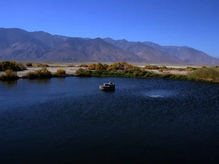
Dirty Socks Hot Spring
California, United States
21 mi away, ~30 min drive
90-94°F32-34°C Free Drive-up
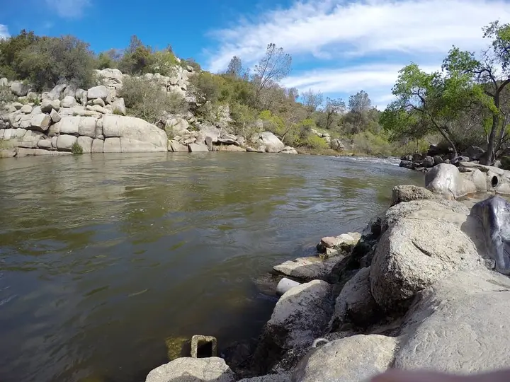
Remington Hot Springs
California, United States
47 mi away, ~1 hr drive
100-106°F38-41°C Free Short walk
Near Big Pine
Wild & natural
Lower Warm Springs (Saline Valley Warm Springs)
California, United States
49 mi away, ~1.5 hr drive
Temp n/a Paid 4WD road
Near Big Pine
Wild & natural
Palm Spring (Saline Valley Warm Springs)
California, United States
50 mi away, ~1.5 hr drive
Temp n/a Paid 4WD road
Near Big Pine
Wild & natural
Upper Warm Spring (Saline Valley)
California, United States
52 mi away, ~1.5 hr drive
Temp n/a Paid 4WD road
88-104°F31-40°C
Resort or spa
All hot springs in CaliforniaAll hot springs in United StatesOpen the full map