Groundhog Hot Springs
Near Crouch, Idaho, United States
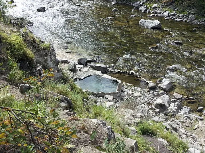
One or two rough rock pools on the bank of the Middle Fork Payette River, the last and least visited of the springs on the trail north of Boiling Springs, reached by a brushy hike with river fords.
- Water temperature
- Not published
- Entry
- Free
- Getting in
- Hike in
- Type
- Wild & natural
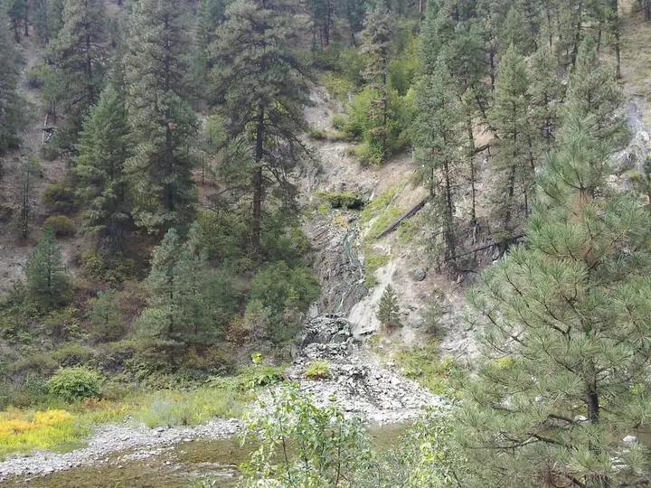
- Water leaves the source at about 140°F60°C and runs roughly 20 feet down the bank into the pools.
- It is the last spring on the trail from Boiling Springs, so it sees far fewer people than the pools near the campground.
- Butterfly Hot Springs, a better-kept rock pool under a small cliff, is a short way upstream.
- The route crosses the Middle Fork Payette several times. Wait for low water in late summer.
What to expect
Groundhog Hot Springs (also written Ground Hog) is a primitive soak on the Middle Fork of the Payette River in the Boise National Forest. It sits at the far end of a chain of springs on the trail that heads north from Boiling Springs, and that location is the whole story. Most people who drive to the end of Middle Fork Road stop at the pools near Boiling Springs Campground. Far fewer keep walking, and fewer still make it this far.
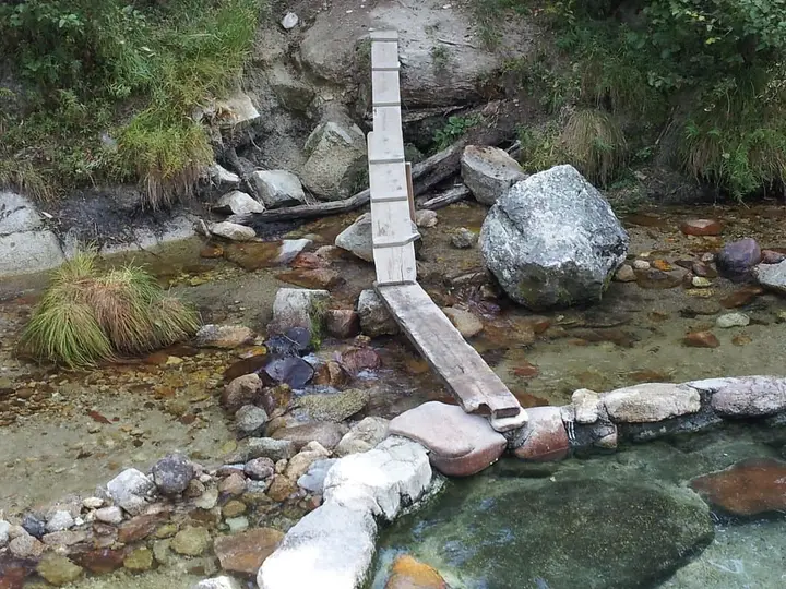
Hot water comes out of the hillside at about 140°F60°C and runs some 20 feet down the riverbank into one or two shallow, rock-walled pools at the river’s edge. How many pools there are, and how usable they are, depends on the river. Nobody maintains them. Expect to restack rocks, plug gaps in the walls and mix in river water to get a comfortable temperature. Some visitors carry a small tarp to line the bottom, which cuts down on leaks and makes the rocky floor easier to sit on.
A short distance upstream is Butterfly Hot Springs, where water at about 130°F54°C drops down a small cliff into a rock pool by the river. Reports suggest Butterfly is usually in better shape than Groundhog, so it is worth checking both before you settle in.
There are no facilities of any kind at either spring.
Getting there
The hike starts in the Boiling Springs area at the end of Middle Fork Road (Forest Road 698), north of Crouch.
- To Crouch: From Boise, take ID-55 north to Banks, then turn east on the Banks-Lowman Road to Garden Valley and Crouch.
- To Boiling Springs: From Crouch, follow Middle Fork Road north. The Forest Service gives the distance as about 24 miles to the Boiling Springs cabin. The upper part is gravel and dirt, dusty in summer with off-road vehicle traffic, and the Forest Service warns that access can be difficult. A normal car can usually make it in dry conditions. Take it slowly.
- The trail: The Middle Fork Payette River Trail (#033) and the Wet Foot Trail leave from a small trailhead near Boiling Springs Campground. The trailhead lot fits only five or six cars and has no restroom or water.
From Boiling Springs the route to Groundhog is about 3.5 miles each way with roughly 450 feet of gain, according to one hot spring guide. There are two ways to go. The main Middle Fork Trail is more direct but fords the river more often. A path along the west side involves fewer crossings and is the safer choice at higher water, but it is steep and slippery in places. Either way you will get wet feet. Past the busier springs closer to the trailhead, the trail is lightly used and brushy, and the Forest Service clears this trail of fallen trees only every few years.
The coordinates on this page come from a hot spring guide rather than an official survey. Carry a GPS track or offline map and expect to search the bank a little.
When to go
July to October is the window. By late summer the Middle Fork is usually low enough that the fords are around ankle deep and the pools are not flooded by the river.
Spring and early summer are a bad time. Snowmelt pushes the river up, the pools go under, and the fords become dangerous. Middle Fork Road itself is usually snow-covered until about late May.
Winter access is by over-snow travel only. The Forest Service says Middle Fork Road is plowed about 13 miles north of Crouch to a snowmobile parking lot near Tie Creek Campground, and Boiling Springs is another 11 miles beyond that by snowmobile. Reaching Groundhog in winter would mean that ride plus the river hike, which is not realistic for most people.
Rules and etiquette
The springs are on Boise National Forest land and free to use. Some guides still describe Groundhog as clothing optional, but that is out of date: a Boise National Forest order prohibits public nudity on all national forest land in the forest from August 27, 2025, through August 27, 2030. Wear a swimsuit here and at Butterfly.
- Pack out everything, including food scraps and toilet paper.
- No soap or shampoo in the pools.
- Leave pool walls in usable shape for the next person, and do not dig into the river channel.
- Respect the Boiling Springs cabin. The pools beside the rental cabin are for the people who booked it.
Where to stay nearby
- Boiling Springs Campground sits at the trailhead between the hot springs, a creek and the river. It has 9 sites with tables, grills and fire pits, and takes RVs up to 30 feet. Camp hosts are present in summer.
- Boiling Springs cabin, a historic guard station next to the campground, sleeps five and is booked on Recreation.gov. It has wood stoves and a propane range but no electricity. Bring your own bedding and lighting.
- Other campgrounds line Middle Fork Road, and dispersed camping is common along it. Crouch and Garden Valley, back down the road, have fuel and basic supplies.
Safety notes
- River crossings: The fords are the main hazard. Do not cross in high or fast water, unbuckle your pack’s hip belt when crossing, and turn back if the river is higher than your knees.
- Hot source water: At around 140°F60°C, the inflow can scald. Mix and test before you get in, and keep your head above the water.
- Remoteness: This is a long way from help. Plan on little or no phone signal, tell someone your route, and carry water, a filter, a headlamp and a map.
- Trail conditions: Brush, deadfall and slick banks are common. Wear sturdy shoes that can get wet.
- Questions: For road and trail conditions, call the Emmett Ranger District on (208) 365-7000.
Map and nearby springs
GPS: 44.39230, -115.83410
Groundhog Hot Springs: common questions
How far is the hike to Groundhog Hot Springs?
About 3.5 miles each way from the Boiling Springs area at the end of Middle Fork Road (FR 698), with roughly 450 feet of elevation gain. The trail is brushy and fords the Middle Fork Payette River several times. Allow most of a day for the round trip.
Is it Ground Hog or Groundhog Hot Springs?
Both spellings are used for the same spring. Most hiking and hot spring sources write it as one word, Groundhog, and pair it with Butterfly Hot Springs just upstream.
How hot is Groundhog Hot Springs?
The source water is reported at about 140°F60°C. The pool temperature depends on how much river water is mixing in, and you may need to let in cold water or wait for it to cool. Test it with your hand before you get in.
When can you get to Groundhog Hot Springs?
Late summer and early fall are the realistic window. FR 698 is under snow through winter and often into late spring, and in spring the river runs high enough to flood the pools and make the fords unsafe. By August the crossings are usually around ankle deep.
Where can you camp near Groundhog Hot Springs?
Boiling Springs Campground, at the trailhead, has 9 sites for tents and RVs up to 30 feet. The historic Boiling Springs cabin next to it sleeps five and is booked on Recreation.gov. Dispersed camping is also common along Middle Fork Road.
Closest hot springs to Groundhog Hot Springs
100-118°F38-48°C
Wild & natural
Dash Creek Hot Springs (Moondipper and Pine Burl)
Idaho, United States
1 mi away, ~10 min drive
100-118°F38-48°C Free Hike in
Trail Creek Hot Springs
Idaho, United States
17 mi away, ~25 min drive
100-110°F38-43°C Free Short walk
All hot springs in IdahoAll hot springs in United StatesOpen the full map
Sources we checked (6)
- hotspringslocator.com/butterfly-and-groundhog-hot-springs
- paultower.wordpress.com/2009/03/31/boiling-springs-hot-springs/
- recreation.gov/camping/campgrounds/232292
- fs.usda.gov/r04/boise/recreation/boiling-springs-campground
- hikingproject.com/trail/7035302/middle-fork-payette-river
- fs.usda.gov/r04/boise/alerts/public-safety-occupancy-and-use-all-boise-national-forest-lands-0