Blayney Meadows Hot Springs
California, United States
An undeveloped warm pool in a high Sierra meadow across the South Fork San Joaquin River from Muir Trail Ranch, reached by a long trail from Florence Lake and a river ford with no bridge.
- Water temperature
- Not published
- Entry
- Free
- Getting in
- Long hike
- Type
- Wild & natural
- The spring sits in an open meadow on the national forest side of the river, opposite Muir Trail Ranch.
- The Florence Lake ferry can cut roughly 4 miles off each way in summer.
- There is no bridge to the spring. You ford the South Fork San Joaquin River at your own risk.
- A popular side trip for John Muir Trail and Pacific Crest Trail hikers resupplying at the ranch.
What to expect
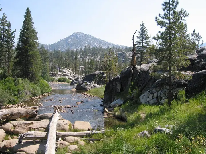
Blayney Meadows Hot Springs (the slug and many trip reports spell it Blaney) is a simple, undeveloped soak in the John Muir Wilderness of the Sierra National Forest, at roughly 7,600 feet. Warm water seeps up in a grassy meadow on the south side of the South Fork San Joaquin River, directly across from Muir Trail Ranch. There is no building, no sign, no staff and no fee. What you find is a warm pool in a meadow ringed by granite, with the river running past and the ranch’s cabins on the far bank.
The spring is a known side trip for John Muir Trail and Pacific Crest Trail hikers who stop at the ranch to pick up resupply buckets. For everyone else it is the payoff of a long hike or an overnight trip from Florence Lake. We could not find a reliable published temperature for the pool, so treat it as warm rather than hot and test it yourself.
Do not confuse the public spring with the ranch. Muir Trail Ranch is a private, family-run guest ranch. It has its own bathing facilities for paying guests, does not rent anything by the hour, has no public restroom, and keeps its showers for cabin guests. The spring you can use is on the national forest side of the river.
Getting there
The route starts at Florence Lake, at the end of a long mountain road east of Fresno.
- The drive: Take California Highway 168 northeast from Fresno to Huntington Lake, then turn onto Kaiser Pass Road. The Forest Service describes Kaiser Pass Road as open to vehicles from late May through November and not recommended for large RVs or trailers. Much of it is one lane with tight curves and turnouts. At the junction of the Florence and Edison Lake roads, continue straight about 7 miles to Florence Lake. Allow plenty of time: this road is slow.
- The trail: The Florence Lake Trail leaves from the west side of the lake and follows the shoreline from higher ground. At about 3.3 miles it crosses the South Fork San Joaquin River on a large wooden bridge, then climbs for about 2 miles on rockier, exposed tread. At 3.9 miles it meets the dirt road that runs from the ferry’s far landing to Muir Trail Ranch. Double Meadow comes at about 5 miles, then a crossing of Alder Creek, then Blayney Meadows at about 6 miles. At about 7.8 miles the Sallie Keys Cutoff heads toward the ranch, and a short path on the right leads to a riverside campsite. The spring lies on the other side of the river from there.
- The ford: There is no bridge. You wade the South Fork San Joaquin to reach the meadow.
GPS tracks put the hike at about 8.4 miles each way, with close to 1,900 feet of total gain on the round trip. Fit hikers do it as a long day, but most people camp.
The Florence Lake ferry
A ferry crosses Florence Lake in summer and cuts roughly 4 miles off each direction. In 2026 it ran until September 13, leaving the road’s end at 9:30 am, 12:30 pm and 3:30 pm and the far side at 10 am, 1 pm and 4 pm. Adult fares were $25 one way or $45 round trip, children $15 or $25, and well-behaved dogs $2 or $4. Buy tickets at the Florence Lake store by cash or card (no reservations), arrive 30 minutes early and park in the upper lot. The store can be reached at 559-377-6400 during business hours. Check the last return boat time before you set off from the ranch, or you will be walking the extra miles around the lake.
When to go
Snow closes Kaiser Pass Road for much of the year, so this is a summer and early fall trip. Early summer has the most water in the river, and that is the problem: the ford can be fast, cold and deep during snowmelt. Late summer is the usual window, when the river drops and the meadows dry out. By mid-September the ferry has stopped for the season and nights at this elevation are cold, but the trail is quieter.
Expect afternoon thunderstorms in midsummer. Start early and be off exposed granite by mid-afternoon if clouds build.
Rules and etiquette
- Permits: Overnight trips into the John Muir Wilderness need a Sierra National Forest wilderness permit, reserved on Recreation.gov. The fee is a $6 reservation charge plus $5 per person, with no discounts. Call the issuing office in Prather (559-855-5355) up to three days before your trip to arrange pickup. Only the listed leader or alternate can collect it.
- Food storage: Bear-resistant containers are recommended for all wilderness travelers and required in some areas.
- Campfires: Fires are restricted in many parts of the wilderness. Check current rules for your route.
- No soap in the pool. It is small and recovers slowly.
- Clothing: No rules are posted and there is no one to enforce any. Some soakers go without suits, so bring one if you prefer.
- Respect the ranch. Do not wander onto Muir Trail Ranch property or use its facilities unless you are a guest.
- Pack out everything. The ranch hauls some trash for its customers but says waste bags are your responsibility.
Where to stay nearby
- Wilderness camping: Muir Trail Ranch has no campground, but free primitive sites are available nearby in the national forest, including the riverside sites near the Sallie Keys Cutoff and another large site about a mile farther on. You need a wilderness permit.
- Muir Trail Ranch: The ranch offers cabin stays, group stays and short stays by reservation. It has no phone in summer and replies to email within about 48 hours.
- Near the trailhead: Florence Lake and the Edison Lake road area have Forest Service campgrounds. Huntington Lake, back at the start of Kaiser Pass Road, has more campgrounds, cabins and lodges.
Safety notes
- The river ford: This is the biggest risk. Muir Trail Ranch says there is no guaranteed safe crossing, especially during high runoff, and that you cross at your own risk. Unbuckle your pack hip belt, face upstream, and turn back if the water is swift or above your knees.
- Remoteness: You are more than 8 miles from the road with no services. Carry a water filter, layers, a map and a light. Do not count on cell service.
- Altitude: At around 7,600 feet, sun and dehydration hit harder. Drink more than you think you need, especially after a soak.
- Wildlife: Black bears live here. Store food in a canister, and never leave it unattended at camp.
- Water quality: Do not put your head under the water in any hot spring, and filter or treat all drinking water.
Nearby stops worth adding
If you have a permit and a few more days, the trail continues past the ranch to the John Muir Trail junction at about 9.2 miles, where hikers head into Kings Canyon National Park toward Evolution Valley. Dogs are not allowed in the national park. On the drive out, the Edison Lake road area offers more lakeside campgrounds before the long haul back over Kaiser Pass.
Map and nearby springs
GPS: 37.23406, -118.88253
Blayney Meadows Hot Springs: common questions
How long is the hike to Blayney Meadows Hot Springs?
From the Florence Lake trailhead it is about 8.4 miles each way by GPS track, with roughly 1,900 feet of total climbing on the round trip. Taking the Florence Lake ferry across the lake saves about 4 miles each way.
How much is the Florence Lake ferry?
In 2026 adult fares were $25 one way or $45 round trip, children $15 or $25, and dogs $2 or $4. Boats left the road's end at 9:30 am, 12:30 pm and 3:30 pm and the far side at 10 am, 1 pm and 4 pm. Tickets are sold at the Florence Lake store with no advance booking.
Do you need a permit for Blayney Meadows Hot Springs?
You need a Sierra National Forest wilderness permit to camp overnight. It is reserved on Recreation.gov for a $6 reservation fee plus $5 per person, and picked up from the High Sierra Ranger District office in Prather. Forest Service guidance says day hikes do not need a permit.
Can you use the hot springs at Muir Trail Ranch?
Not as a day visitor. Muir Trail Ranch is a private guest ranch that does not rent its facilities by the hour, and its showers are for cabin guests only. The public spring is the one across the river in the national forest meadow.
Is it safe to cross the river to the hot spring?
Not always. There is no bridge, and Muir Trail Ranch warns that there is no guaranteed safe crossing, especially during high runoff in early summer. Late summer is the usual season for the ford. If the water is fast or above your knees, do not cross.
Closest hot springs to Blayney Meadows Hot Springs
Near Mammoth Lakes
Wild & natural
Iva Bell Hot Springs (Fish Creek Hot Springs)
California, United States
22 mi away, ~35 min drive
Temp n/a Paid Long hike
Near Mammoth Lakes
Public pool
Whitmore Hot Springs (Whitmore Pool)
California, United States
28 mi away, ~45 min drive
Temp n/a Paid Drive-up
88-104°F31-40°C
Resort or spa
Near Mammoth Lakes
Wild & natural
All hot springs in CaliforniaAll hot springs in United StatesOpen the full map
Sources we checked (6)
- hikingproject.com/trail/7016152/florence-lake-trail
- 10adventures.com/hikes/sierra-national-forest/blayney-meadow-hot-spring-hike/
- muirtrailranch.com/just-passing-through
- muirtrailranch.com/florence-lake
- recreation.gov/permits/445858
- sierranewsonline.com/snf-announces-kaiser-pass-and-florence-lake-road-repairs/